Sector F, Noida
+91 9891555001 / 9311475175
info@mytechpro.co.in

Construction Progress Survey

Drone-based construction progress surveys that provide accurate aerial mapping, site monitoring, 3D visualization and measurable progress insights for smarter project management.

Request Survey
CONSTRUCTION PROGRESS SURVEY

Monitor Construction Progress from Above

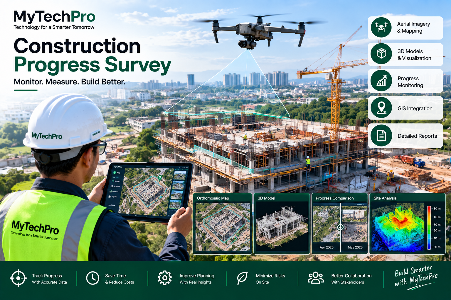
MyTechPro provides professional drone-based construction progress survey solutions that help project teams capture, monitor and document site development through high-resolution aerial imagery, mapping and 3D visualization.

Regular aerial surveys create a visual and measurable record of construction activities, allowing project managers, engineers and stakeholders to compare actual site conditions with planned development and identify progress across different stages of construction.

✔ Drone-Based Construction Survey
✔ High-Resolution Aerial Site Photography
✔ Construction Progress Monitoring
✔ Orthomosaic & Site Mapping
✔ 3D Construction Site Modeling
✔ GIS-Based Project Visualization
✔ Earthwork & Stockpile Measurement
✔ Regular Progress Documentation
Construction Progress Survey
OUR CONSTRUCTION SURVEY SERVICES

Complete Construction Progress Monitoring

Capture accurate site information and transform aerial data into useful project progress insights.

Drone Site Survey

Capture high-resolution aerial imagery of construction sites for regular progress monitoring and documentation.

Construction Site Mapping

Generate detailed site maps and orthomosaic imagery to visualize roads, structures, work areas and construction activities.

3D Site Modeling

Develop 3D models of construction sites for visualization, progress comparison and project documentation.

Progress Monitoring

Conduct periodic surveys to create a visual record of construction progress and compare site conditions over time.

GIS Integration

Integrate construction survey data with GIS platforms for spatial visualization, asset mapping and project analysis.

Progress Reports

Receive structured aerial imagery, maps, measurements and survey documentation for project reporting and stakeholder communication.

Drone Construction Progress Monitoring
PROGRESS MONITORING

Create a Visual Record of Project Development

Construction sites change continuously. Periodic drone surveys provide consistent aerial documentation that can be used to review how the project has developed over different survey dates.

Project teams can use these datasets to visually compare completed work, active construction zones, site access, material storage and other visible project elements.

✔ Periodic Drone Surveys
✔ Date-Wise Site Photography
✔ Before & After Comparison
✔ Construction Area Visualization
✔ Work Progress Documentation
✔ Digital Project Records
SURVEY OUTPUTS

Construction Data You Can Visualize & Measure

Convert aerial survey data into digital outputs that support construction monitoring and project management.

Orthomosaic Maps

High-resolution aerial maps for site visualization, documentation and spatial reference.

3D Models

Detailed three-dimensional representations of construction sites and structures.

Point Clouds

Dense spatial datasets that can support site visualization and measurements.

Aerial Imagery

High-resolution aerial photographs for project records, reporting and stakeholder communication.

EARTHWORK & MATERIAL MONITORING

Monitor Earthwork, Excavation & Stockpiles

Drone mapping can provide detailed aerial datasets for visualizing excavation areas, soil movement, material storage and stockpile locations across construction sites.

Processed survey data can also support measurements and comparison of site conditions across different survey periods.

✔ Excavation Area Mapping
✔ Earthwork Visualization
✔ Stockpile Mapping
✔ Volume Measurement Support
✔ Material Storage Monitoring
✔ Time-Series Site Comparison
3D Construction Site Mapping
APPLICATION AREAS

Construction Projects We Support

Road & Highway Projects

Monitor road construction, earthwork, structures, corridors and project development through regular aerial surveys.

Building Construction

Document building construction stages, structural development, site conditions and surrounding areas.

Bridges & Infrastructure

Capture aerial information for bridges, infrastructure corridors and major structural development projects.

Industrial Projects

Monitor large industrial construction sites, facilities, equipment areas and supporting infrastructure.

Urban Development

Map and monitor large-scale urban development, infrastructure expansion and planned project areas.

Solar & Energy Projects

Survey large solar and energy project sites and document construction and infrastructure development.

OUR WORKFLOW

From Site Survey to Progress Report

01. Plan

Define the project area, survey requirements, monitoring frequency and required outputs.

02. Capture

Conduct planned drone flights and capture high-resolution aerial imagery of the project site.

03. Process

Process imagery to generate maps, models, point clouds and other required survey datasets.

04. Monitor

Compare survey results over time and prepare progress documentation for project stakeholders.

KEY BENEFITS

Smarter Construction Monitoring

Better Site Visibility

Get a comprehensive aerial view of large and complex construction sites.

Regular Monitoring

Conduct scheduled surveys to maintain a consistent visual record of project development.

Data-Driven Insights

Convert aerial data into maps, models and measurable information for project review.

Better Documentation

Maintain date-wise aerial imagery and digital documentation of project progress.

GIS Integration

Connect construction survey information with GIS platforms for improved spatial project management.

Stakeholder Communication

Share clear aerial visuals, maps and reports with clients, consultants and project stakeholders.

Need Reliable Construction Progress Monitoring?

Monitor your construction project with drone surveys, aerial mapping, 3D models and GIS-based progress data.

Request a Survey